Various Collier County, Florida maps.

|
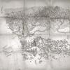
1887 Plan of Naples (front). |

|
1887 Plan of Naples (back). |

|
1889 Naples Company map. |

|
Plat of burial grounds at Rosemary Cemetery, Naples, situated between the Tamiami Trail and Seaboard Railway right of way. Shows grave sites both identified and unidentified. Dated February 1944.
Accession number: 79.13.26. |

|
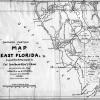
Map, of the southern portion of East Florida, compiled by Captain John Mackay and Lieutenant J.E. Blake 1840. |

|
Ten Thousand Islands, 1927. |

|
1947 Collier County map by D. Graham Copeland. |

|
Frank's subdivision plat - a subdivision of Lot 85, Naples Improvement Company's Little Farms, 28th Avenue North, Naples. January 1957. Former owners: Rudolph and Lela Frank. Certificate of survey signed by W.R. "Plumb Bob" Wilson. |

|
Collier County map from Florida 1845-1975 Historical Chronicle featuring Collier County, 2nd edition, week of October 6, 1975. |

|
This article appeared in Florida Historical Quarterly (Vol. XXVI, No.4) April 1948. It describes the 1947 Collier County map by D. Graham Copeland. |
Please give proper credit if using these images/documents. Credit line should read Courtesy of Collier County Museums, Naples, Fl.